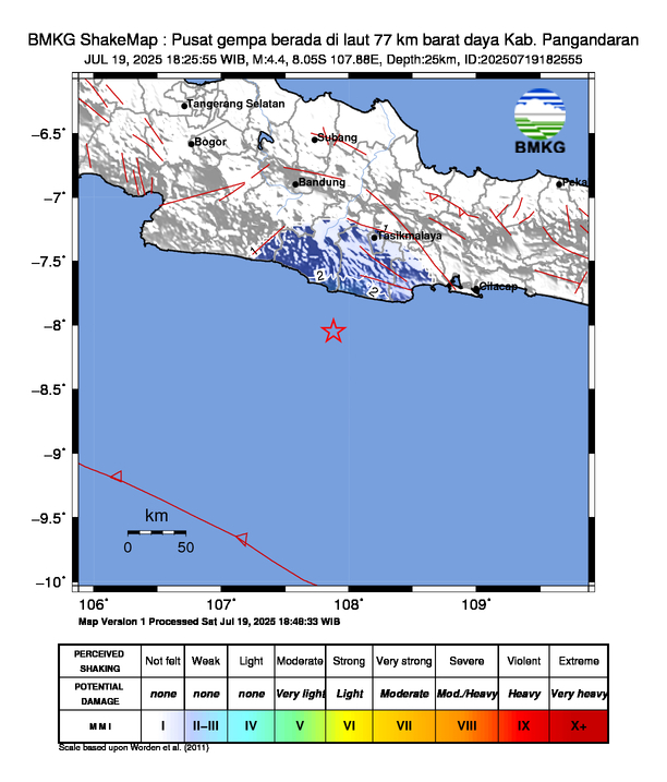
Quakemon is a real-time earthquake monitoring application that utilizes official data from BMKG (Indonesia's Meteorology, Climatology, and Geophysical Agency). It integrates multiple BMKG data sources including recent earthquakes, felt earthquakes, and shakemap images to provide fast and accurate earthquake insights across Indonesia.
- Displays recent earthquakes in real-time
- Shows felt earthquakes reported by the public
- Integrates shakemap images from BMKG for visual impact zones
- Provides details like location, magnitude, depth, affected areas, and tsunami potential
- Supports both JSON and XML formats from BMKG APIs
- JavaScript / TypeScript
- Node.js / Next.js / React (depending on implementation)
- Fetch API / Axios
- XML & JSON parsing
git clone https://github.com/your-username/quakemon.git
cd quakemon
npm install
npm run devSample BMKG data structure (XML/JSON) is available at docs/data-example.md
Pull requests are welcome! Feel free to fork this repo and add features like map integration, push notifications, or data visualization.
All data is fetched directly from BMKG. This project is a data visualization tool and is not responsible for the accuracy, delay, or content of the information provided.
© 2025 Quakemon Project — Built with ❤️ for Indonesia.